Stuchd an Lochain
Statistics
Area: Loch Rannoch to Glen Lyon
Munro: Stuchd an Lochain
Date walked: 14/01/2012
Time taken: 2.2 hours
Distance: 9 km
Ascent: 750m
The Route
Introduction
I had been looking at trying to pop over to Glen Lyon for some time now to bag the Munro, Stuchd an Lochain. I had done the Munro’s over this area apart from this one and it seemed like a shame to come all the way over here in the summer to do one Munro when there are so many multiple routes that can be achieved in the better weather with longer days. So in my mind it had to be a winter Munro. The problem with winter in this area is access, normally. In the winter months the drive up to The Dam at loch an Daimh is treacherous with ice and snow all over the road. If you drive up from Killin then you have a 20km drive from when you leave the main road on a potentially ice and snow covered road . However as luck would have it we are currently experiencing a very mild January. I had to walk up to the snow line to Ski yesterday at Cairngorm because all the snow below 800m has melted and with the weather forecast to be mild on Saturday I decided this was a great opportunity to bag this Munro.
The Walk
So got home last night packed the ski’s away and prepared my walking kit for a morning jaunt on the hill. It’s one of the easier Munro’s due to the start at 400m but the views from the top in the forecast sunshine were going to make it a good day. So up at 0530 and on the road at 0630. Two hours later after an uneventful drive with very little ice on the road I was at the car parking area in front of the dam. A small herd of deer moved of the road and onto the hillside on my arrival.
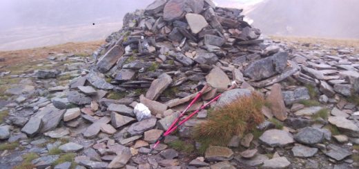
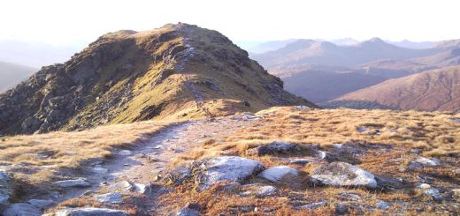
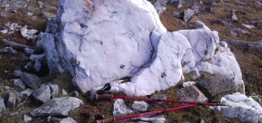
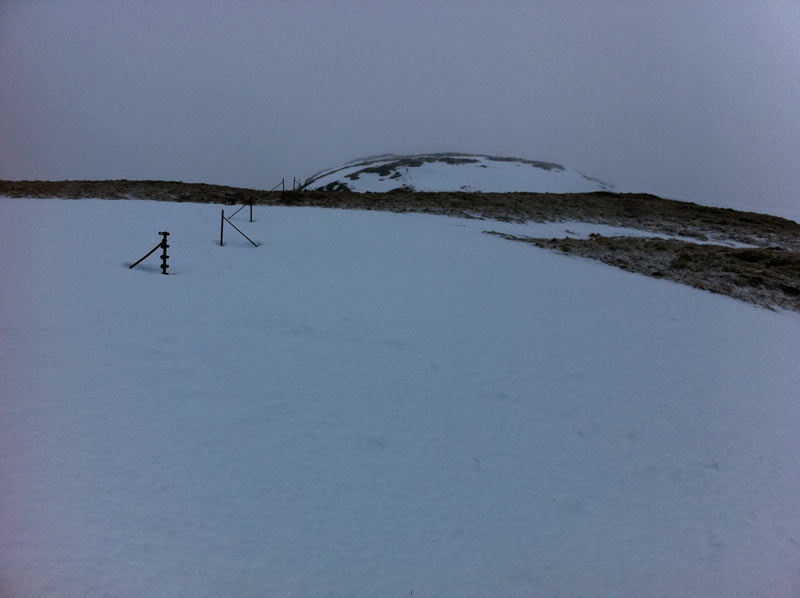
On with walking boots, check crampons and ice axe, and I am jogging up to the dam. The gate here is locked but it is small and easy to climb over. After a 100m or so there is the small cairn indicating the steep path up the hillside. The path, like most hill paths, double as a drainage ditch for the hillside as the water finds it easier to drop down the path rather than force its way down through the heather. And with the temperature at 0 degrees and overnight much lower a lot of the water is frozen making the path quite slippery. So I decided to head directly up the heather by the side of the path making good headway as I went. Its quite a steep slope but I am soon up at 800m or so. At this point there is a steep snow slope leading to the spot height at 887m. The snow on top is soft enough to get my toes into so I don’t bother with crampons at this point but I do have my Ice axe in the arrest position in case I take a tumble. Truth is I would not fall far but better safe than sorry. As it happens I ascend the snow without incident. There is a line of fence posts here and it’s just a matter of following them for approximately 2.5km to the summit of the Munro. The route follows the edge of the Corrie around lochan nan Cat but it’s all in the clag and I only get the briefest glimpse of the Lochan. The final climb to the summit, the last 50m, is a very steep snow slope so I stop to don crampons and I am soon at the summit cairn. Some good views of mist in all directions unfortunately. So much for the sunshine. So nothing left but to retrace my steps. I remove my crampons and have some good fun glissading down both large snow slopes. Care is required on the top slope due to the close proximity of the Corrie. After descending the snow from the 887 spot height I meet another walker ascending. He has stopped to don crampons. A quick chat and I set off jogging down the hillside past the path and over to the undulating steep hillocks of Coire Ban. Not on purpose you understand, but I thought of another use for the ice axe and used it as an anchor to descend the steeper (near vertical) sections of grass. I can see another two walkers on the path below me and as I jog from the dam I meet three more. Looks like it will be a popular hill to walk today.
I walked hard today and was quite pleased with the effort. The glissading was fun but coming down off Coire Ban was not one of my best decisions.
P.s. After I past the spot height at 887 my gps seemed to loose accuracy by about 100m for a while. The gps track back down the Coire Ban is correct but I do not advise anyone to descend any other way than by the main path.