Avon calling

Statistics
Area: Cairngorms
Munro’s: Beinn a’Bhuird, Beinn a’Chaorainn (Cairngorms), Beinn Bhreac, Ben Avon
Date walked: 26/02/2012
Time taken: 10.22 hours
Distance: 47 km (walk 35km, cycle 12km)
Ascent: 2000m
Introduction
Weather constant drizzle all day with few breaks. Cold wind starting at 20mph raising to 60mph by 3pm. 80 per cent off the walk in the thick clag. A drechit miserable day.
The Walk
Ok so another weekend approaching and another hill to bag. I like to walk on Saturdays and have a relaxing Sunday to recover but I had to work on Saturday and therefore a Sunday walk was to be planned. I was looking a single Munro to take me to the 200 point and the logical choice for me was Carn a Mhaim. However, I felt ready for a bigger round. Big rounds at this time of year are normally very difficult due to the high levels of snow on the hills but it has been extremely mild this February and having watched the ski cameras all week the snow had all but disappeared. Mwis forecast for Sunday in the Cairngorms was for Gale force winds starting at 20-25mph in the morning to 60-70mph in the afternoon. I had looked into doing the Ben Avon round of four hills cycling in from Linn of Quoich a number of times last year but never got around to doing it. With the forecast as it was and no snow left I figured I could get around to Ben Avon before the winds reached Gale force if I tackled Beinn Bhreac first. If the strong winds came in early or walk didn’t go as planned I could always drop into Glen Derry from Bein a Chaorrain or take the path South from Beinn a Bhuird back to the bike.
So the plan was hatched late on Saturday night and I was up and out the door at 0520 on Sunday morning. I arrived at the parking area at around 0730. I set of at 0745 pushing the bike up the small track justSouth of the closed gates at Linn of Quoich. This track then shortly joins a Landrover track which undulates for 6km North West following the route of Quoich water as it heads into the valley. I hadn’t cycled for over a year and found it hard work so I deliberately did not work too hard. After 45 minutes I was at the ford and end of the cycle in. The weather was looking good. It felt almost like a summers day with the sun almost coming through. This was not to last unfortunately.
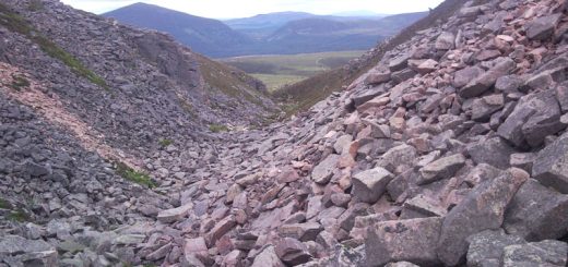
I now head back up the small hill I had just descended and then head west up the side of the forest on a rough Landrover track. After a short walk the track disappears and it’s now a slog up the undulating heather heading West then north around the summit of Meall an Lundain, which was in the clag and then onwards to Beinn Bhreac. The clag started at around 700m and I was soon in it on pathless terrain heading for Beinn bhreak. I could not see anything. It always a bit debilitating and although I had gps on my phone I was reverting to compass bearings to assist and help with ascertaining the accuracy of the gps. Just below Beinn Bhreak I found a path going in what seemed like the right direction but it took me passed the summit heading towards the Bealach. Once I realized this I doubled back and in a short time I was at the summit cairn.
It’s now a 6km walk pretty much north over the boggy peat hags of the Moine Bhealaidh. I leave Beinn Bhreac heading North West in order to stay on the high ground. Still in the clag I find a path that seems to be going in the right direction. However the path must have been slowing bending West without me realizing it in the clag and after just over 1km I check my compass and I am heading west. This area is a large plateau with no landmarks I immediately head North and sticking to the high ground the mist lifts fleetingly just to give me a glimpse of Beinn a Chaorainn. Another few km’s over the hags and I am climbing up to the summit reaching the summit at 1126. The rain or maybe the mist has soaked my trousers and the cold wind is picking up so I put on my waterproofs and keep them on for the rest of the journey.
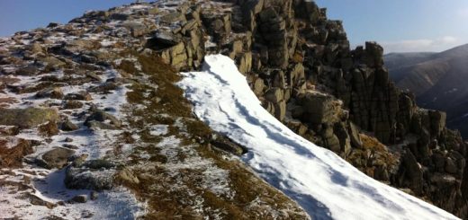
My fingers get cold very quickly when I stop so I quickly head off in the direction of Beinn a Bhuird. There has been virtually no snow around so far but I now see some large patches and have to cross some on the journey. At each patch I stow my walking poles and take out my ice axe because some of the patches are steep. It’s not a problem and this is the routine for the rest of the walk. Its simply a matter of heading South for 2km and then East for 4km to get to the summit of Beinn a Bhuird. However the mist is as thick as pee soup. It difficult to read the terrain and the only landmarks I have are a small Lochan 1.5km below the summit which I was glad to see and two Lochans 2.5km below the summit of Beinn a Bhuird. I lost the gps signal completely at the first Lochan and had to rely on compass bearing for the next 4km. Its not a problem though as the route just climbs not to steeply up to the Munro. I did wonder if I was heading slightly South because I was clambering up rock clusters as I ascended but after a short time I was heading up the final pull to the summit. I just couldn’t find it. This is a big plateau and I had to search around to find the cairn in the mist. A stop for more refreshments is required. It dreich and wet and misty.
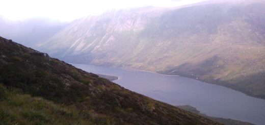
Only one more Munro left. Ben Avon. Its now a couple of km’s across the plateau descending slightly and re-ascending to some smashing tors at the spot height. I was wondering where they were when all of a sudden the mist lifted briefly and showed me the way. As I got past the tors and started on the steep descent to the Bealach The mist lifted giving me my first real views of the day. However it was now 1400 and the wind was blowing from the South East very strongly. I was hoping I would get to Ben Avon before the wind strength increased but it was not to be. The path to Ben Avon was clear in front of me thought so that was a good sign. As I was ascending I met the only walkers I had seen all day coming back down. After a quick chat I continued on my way up to the plateau and then onwards to the clag hidden Ben Avon summit. The wind was ferocious whistling through the tors. I gingerly climbed up the front face to the highest point I could safely touch with an outstretched hand. So safe in the knowledge I bagged the summit I climbed back down to another well earned set of refreshments.
That’s the Munros bagged and now for the walk out. Back to the Bealach where there is a path South which I follow for 4kms. The path is rough for the first km but then joins a well-made path heading out the valley. At the 4km point I head west for the 4km through the forest and back to the bike. Both my knees are a bit sore and twilight is fading so I take it reasonably easy on the cycle back to the car.
An epic day out with a large dose of sensory deprivation spending so long in the drechit all consuming clag.