Ciste Dhubh and Am Bathach

Statistics
Area: Loch Duich to Cannich
Munros: Ciste Dhubh
Corbett: Am Bathach
Distance = 13km
Ascent = 1040
Time = 3hours 20 mins
The Route

Introduction
After our long walk on Sunday we decided to have a rest on Monday. Not that it mattered much because it rained since we finished our walk on Sunday night until Tuesday morning and we would not have been to happy to do a walk in the rain after our excertions the day before. We had rested all Monday and needed to do a walk today to wake the legs up so the easier walk of Ciste Dhubh and Am Bathach was our chosen walk. In fact it was still raining as we set off on this walk but it was merely a shower and looked like it was easing. The hilltops were still in the mist but it wasn’t cold and we did not anticipate a long walk.
The Walk
We drove the 1.5km along the road from the Cluanie Inn to a large parking area beside a small copse and set off on our walk. At the end of the copse there is a small steel gate which leads to the path up to the corbet Am Bathach. Since we were going to climb both hills, we went this way. It was an easy enough climb up the hillside, although a little steep, for about 1.5km then it levels out for another 1.7km aproximately to the summit of Am Bathach which we reached in 1 hour. Initialy the ground was boggy and in fact, due to all the rain lately, the hillside was also very wet.
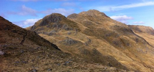
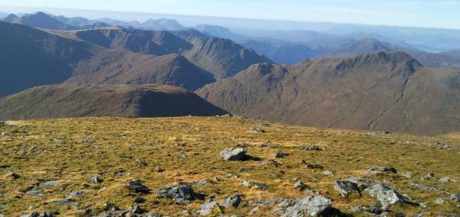
It was then simply a 1km walk down the hillside to the beallach Choinich, cross some boggy ground and then climb up the steep slope to the summit of Ciste Dhubh. Again the hillside is drenched with water which cascades down the obvious path which leads up the hillside. Once you get over the first ascent and up to the spot height of 929, Ciste Dhubh stands impressively in front of you another 50m higher with its vertical crags and cliffs along its East face. It was not long before we had ascended the final few metres to the summit. The mist had lifted to a point and we had some nice views.
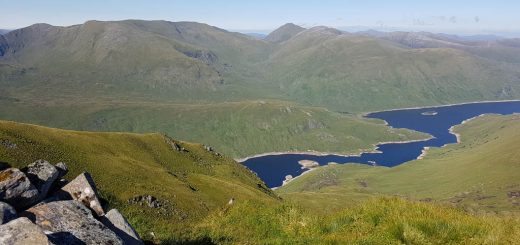
We then set off North East down the obvious grassy ridge and then East heading down into the Corrie. The ground underfoot was bog all the way and we soon crossed the burn to join what looked like like a path but it all honestly it was as boggy as the coire hahaha. This bogginess continued until the track turned into a landrover track about 2.5km from the road and then the conditions underfoot improved but it was very stony for the rest of the way so I found it uncomfortable. However with Danny route marching down the track it was not long before we were back at the car.