Ben Lui Group of 4
Statistics
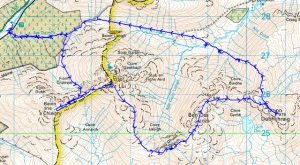
Area: Inveraray to Crianlarich
Munros: Beinn a’Chleibh, Beinn Dubhchraig, Ben Lui, Ben Oss
Date walked: 30/05/2010
Time taken = 6 hours 55 mins.
Distance = 22.5km
Ascent = 1700m
The Route
Introduction
The Walk
So, early rise at 0430 and on the road at 0510. I arrived at the carpark, on the A85 Oban road at grid ref NN239278, at about 0650 and was kitted up and on my way by 0700. There were a couple of cars and a campervan in thecar park so I thought I might meet some people on the hills today I followed the track out the back of the car park and along the side of the river for about 100m at which point I had to cross the river. The river was low and it was easy enough to cross on the stones without getting wet. I then climbed the fence and crossed the railway climbing the fence on the other side. There is a clear path through the forest which runs adjacent to the burn but it is quite boggy in places. There is supposed to be a fire break in the forest leading to the ridge going up to the corbett but It looks like its been planted with trees After about 1.5km I noticed a “Ben Lui nature reserve” sign across the river and crossed the river at this point. I now crossed the deer fence via the stile and headed up the clear track in the hillside. The track meanders up the hillside in a SE direction for 1.5km to the beallach continuing SW for another 1km to the summit of Bein a Chleibh. Unfortunately the summits were in the mist/cloud for the moment so after a quick photo I was heading back down to the beallach and then onward to Ben Lui. There was a cold wind on the summit.
Care needs to be taken here that you don’t head back down the track you just came up on, especially in the mist.
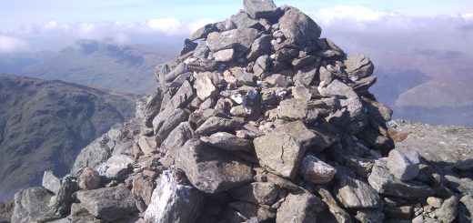
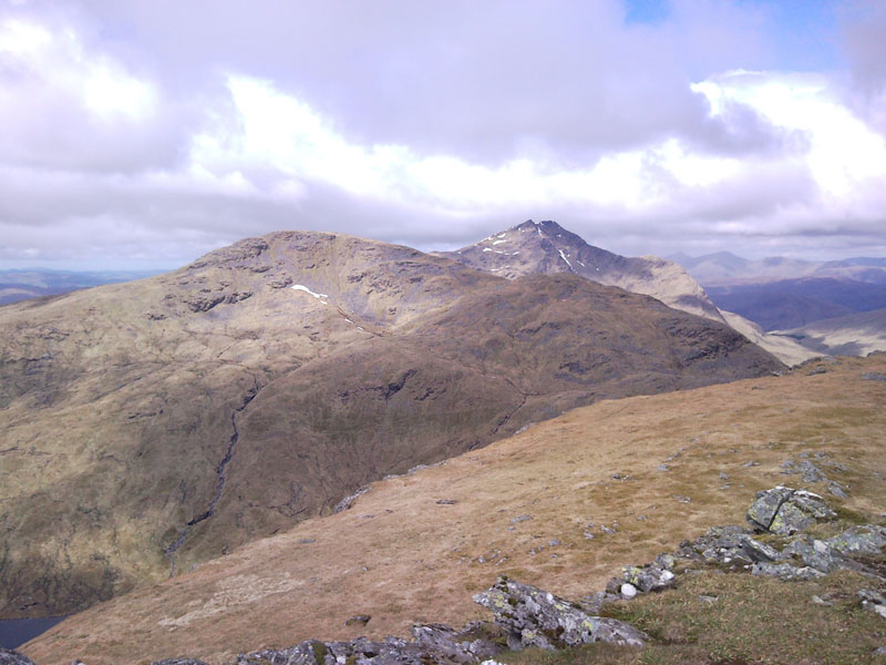
Its now a straight forward 350m ascent up to the summit of Ben Lui. I didn’t notice it being particularly steep at any point and I was soon on the summit. (2 hours from leaving the car park). Again I am in the mist so quick picture and head off in the direction of Ben Oss.
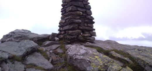
I head off SE then S descending 400m to the beallach and then ascend 300m to the summit of Benn Oss. Its a clear path and has no difficulties. The mist has almost lifted off Ben Lui now but the cold wind is increasing in strength. So I take some pictures and head of to the final munro.
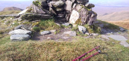
Beinn Dubhchraig is about 3km from Ben Oss walking in an arc heading N, E, then SE descending and ascending about 200m. Its cold and the wind is now howling. This munro has the only shelter from the wind on the round so I make full use of it, eat my lunch and have 10 minutes of shut eye. All I have to do now is walk out hahaha.
I head NW then N for 1km looking for a suitable descent down the slopes of Coire Bhuide. The descent is pathless but not too steep and the ground is nice grassy tufts making it reasonable going. I descend for 1.5km dropping 500m by which time my knees are screaming (glad I had my poles with me) . I walk over to the river looking for a crossing and find the most amasing hidden waterfall. There is a landrover track about 80m above me which I traverse up to and head along for about 50m. At this point I need to leave the track (its ending anyway) and follow a line of defunct fence posts for the next three km NW. The ground is sodden with plenty of bogs and there is no track to speak off. I am tired at this point and it seems like a slog. I eventually arrive at the start of the forest and skirt around the south edge following the deer fence which takes me back to the stile over the fence at the nature reserve sign.
Its now back over the fence, river and head back down the forest track. I meet a couple coming up the forest track, the first walkers I have seen all day, and they are going up to do the first two munros. I cross the railway and then jump into the river up to my knees to give my tired legs and feet some soothing cold comfort. So back to the car at 1355.
Pleased with the day but tired. (didn’t sleep much during the night and the early start has finished me off.