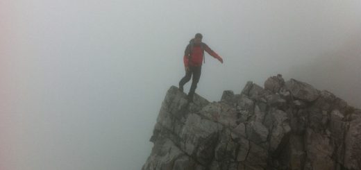
Maol Chean Dearg (Torridon) in the clag
Statistics
Area: Applecross to Achnasheen
Munro: Maol Chean-dearg
Date walked: 24/07/2012
Time taken: 4.5 hours
Distance: 16 km
Ascent: 950m
The Route
Introduction
I arrived in Torridon on Monday night for a couple of days walking and had planned a group of Munro’s for the Tuesday. However, due to the forecast strong winds I decided to walk Maol Chean Dearg from Coulags as a single walk instead.
The Walk
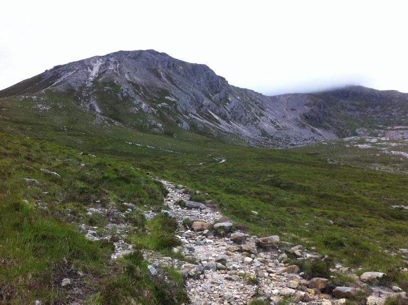
So after a reasonable nights sleep and a long lie in I was ready to walk at around 1020. There were some heavy clouds around but it was dry and the wind was only light at the van but enough to keep the midges down. I walked in on the well signposted road to the lodge. Just before the cattle grid there is a small path indicated by a large cairn. There is a small boat on top of the cairn for dome strange reason and for an even stranger reason I missed this and crossed the cattle grid and walked around to the lodge. There is a large black gate here but I think the landowner would prefer walkers to use the path by the cairn. The path continues North for 2km’s following the burn up the valley whereupon it crosses the burn on a good bridge. The rain had been off and on at this point and so had my waterproofs. After another 1km or so I arrived at the bothy.
Its quite well laid out with rooms upstairs and downstairs. It was quite tidy although there was a small waste basket full of paper and stuff which could have been taken out by the user. On second thoughts it could be used for fire starting so no harm done there. After leaving a quick note in the visitors book I was again on my way walking up the path. After 4.5km from the road the path forks. The left fork bends West for 2km’s up to the Bealach a Choire Gharb whereupon the path heads North again for the 1.5km climb to the summit of Maol Chean Dearg. The wind had been increasing in strength as I approached the Bealach and from now on it was gusting very strongly and knocking me over on occasion. In conjunction with the rocky terrain I was not 100 per cent confident of continuing. I persevered and followed the path as it appeared and disappeared. I was now in thick clag and was expecting the final 100m climb to appear but instead the terrain changed to steep downhill?
I was confused for a moment and for an instant I thought I would have to descend back down the hill without bagging it hahaha. There is a small spot height just South of the summit and I had managed to walk over to it in the clag. I could not see the real summit due to the clag but if I headed North east for 50m or so I would soon be on the steep rocky climb to the summit and this proved to be the case. Shortly after I was having a good break in one of the shelters built into the main cairn. It was now just a matter of retracing my steps back to the car.
I met a few walkers and mountain bikers out today. I hope they got on ok higher up.