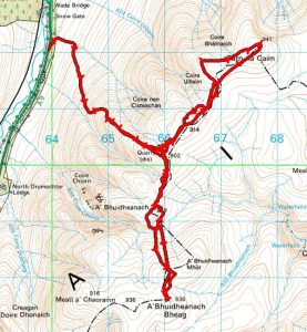
A’Bhuidheanach Bheag and Carn na Caim
Statistics
Area: Loch Ericht to Glen Tromie and Glen Garry
Munros: A’Bhuidheanach Bheag and Carn na Caim
Distance: 19km
Ascent: 850m
Time: 3hours 13mins
The Route
Introduction
I Got up late today so changed my walking plan to the two munros on the East of Drumochter pass. I arrived at the car park 3km north of Balsporran Cottages at 1015 and set of on my walk at 1020.
The Walk
I crossed the road and walked the 50m to the entrance gateway to the road going up the hillside. There is another gate after another 50m and then its a relentless slog up the path all the way to spot height at 902m. The path is stony but is quite wide and its easy going.
The temperature at the car was 4 degrees and there is snow on the hills. There is also a cold northerly wind blowing so I was not going to hang about. When I got to the spot height I met a walker that had started much earlier. He told me he walked in the freezing rain and it was not very nice. He bagged Carn na Caim and was heading back down. Luckily for me the rain had stopped and even though there was some pretty dark clouds overhead I managed to complete the round with no rain.
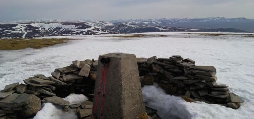
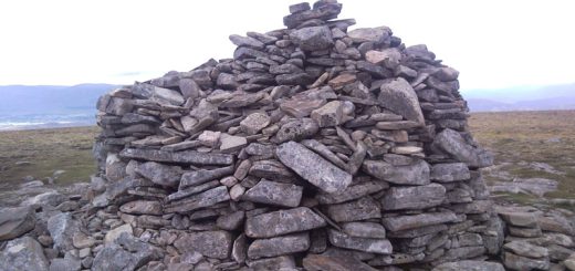
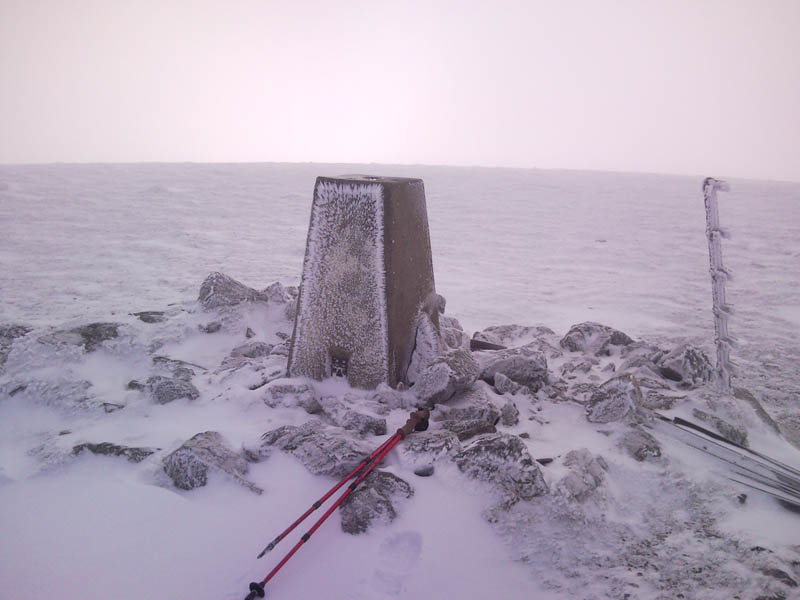
My plan was to go to A’Bhuidheanach Bheag first and then Carn na Caim so at the spot height I followed the landrover tracks South to the summit of A’Bhuidheanach Bheag at 879m. There is a large cairn here which indicates the track down to the valley but I was not paying attention and missed it hahaha. I could see the obvious track across the valley heading up the hillside and I expected the landrover track to go around the hillside and join it. However after 200m or so I decide to head across the Tundra and down into the valley and up the path. The path is covered in snow but is pretty obvious. It goes uphill to join the boundary fence and then follows the fence South form the last 0.5km to the trig point at the summit. The summit is in a bit of a whiteout with low cloud so there are no views.
I retrace my heading back down to the valley and I take the obvious path which goes back to the spot height at 879m. The one I missed on my outward journey. I see a couple of walkers a few metres up the landrover track looking at there maps. They are following my footsteps and realise something is not quite right hahaha. I explain my error and they head of down the track into the valley. I continue on my way and after another 700m I meat a group of stalkers/hunters I suppose. Some of the guys had beating sticks and were moving through the artic tundra whilst a guy with the most impressive Golden Eagle waited patiently.
I am not sure which poor beast they were chasing but the eagle looked incredible and I am not sure if anything would escape its huge talons once it was let loose. I quickly passed the 902m spot height on my way across the featurless snow covered plain. I followed the snow covered landrover track North East and continued following it as it turned North when at this point tI should have followed the boundary fence North East for the last km to the summit of Carn na Caim. Consequently I realised I was bypassing the hill and after going 400m the wrong way I corrected my bearing and headed cross country directly to the summit. Its now a case of following the boundary fence and rejoining the landrover track which takes me back to the spot height at 902m and then down the hill back to the car. I arrive at the car at 1333.