Beinn Fhada and A’ Ghlas-bheinn
Statistics
Area: Loch Duich to Cannich
Munro’s: A’ Ghlas-bheinn, Beinn Fhada
Date walked: 31/03/2012
Time taken: 6.5 hours
Distance: 23 km
Ascent: 1700m
The Route
Introduction
After walking Beinn Sgriteall yesterday and drinking a few whiskies again on the Friday night I was ready for an easy group walk up the two Munros I had left to bag in Kintail.
The Walk
A number of friends were going along on this one. So after a late start we were on our way not long after 10am following the track on the South side of the Abhainn Chonaig. The track contours around the lower slope of Beinn Bhuidhe and after 40 min’s or so we arrived at the burn crossing. Alan set of first across the water in order to video the group crossing and in his haste nearly went for a swim. Needless to say no one had a camera at the ready and no harm was done. We continue on the path heading North East towards Bealach an Sgairne but then take the fork heading South South West slightly descending into the corrie and then climbing again up to the Bealach below Meall a Bhealaich. We have passed and are passed again by another group heading up to walk Beinn Fhada.
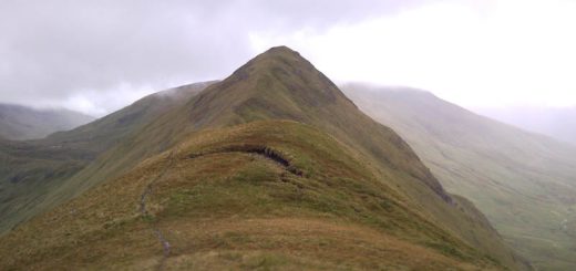
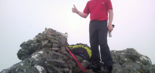
The troops are doing well. Alan, Danny and Tam are taking it in their stride. Nathan, after walking all week is finding this one a little hot and Allan, with a dodgy hip, has said he is content to stroll along at the rear. From here it’s only 1.5km for the final ascent up to the summit. We stop at the summit for a break and regroup with everyone getting up to the summit with no problems. After a quick discussion it seems like I may be the only walker definitely going to the summit of A’Ghlas-bheinn. For one reason or another the lads may not be going to the second Munro so I make a decision to head of myself. (As ithappens Danny, Tam and Nathan all summited the second Munro so maybe they just wanted rid of me hahaha).
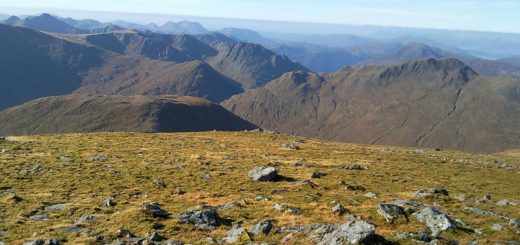
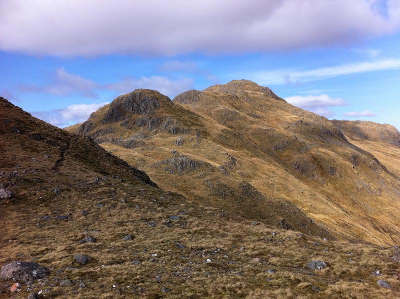
So I set of down to the Bealach and then onwards over the top of Meall a Bheallaich. I had heard that the North face was very steep and dangerous so I chose to Head East descending down the slightly craggy hillside and then contour round to Beallach an Sgairne. There were a couple of hairy moments but nothing too severe and I was soon on the steep path up to the first top of A Ghlas Bheinn. I stopped for a bite to eat and in the process dropped my neck roll scarf. (Danny collected this on his way round thanks). After another couple of small ascents I was on the top of Munro number two A’Ghlas-bheinn. The weather had been excellent today with some lovely sunshine but the wind was a little cold when stopping. From here I choose a route down the hillside which I would not recommend to my worst enemy. (Better to go back the way you came to beallach an Sgairne and take the path back out the valley).
I headed South West ish down the hillside from the summit. The descent over the first 200m was fine but then it became seriously steep for the next 350m of descent. Looking down it looked like the forest was actually underneath my feet and at any time I was just going to fall off the hillside. There were also crags to avoid as I descended. If the grass had been wet I would have fallen off no doubt but fortunately the grass was bone dry and my boots were sticking nicely. I was relieved when I got down to the forest however this was not the end of my problems. I still had to descend nearly 200m through the thick forest. In Orienteering terms this was “fight” of the worst kind. I remember now reading Carols report on this walk and she had descended similarly and ended up descending backwards through the forest hahaha.
Still I knew if I persevered I would soon be out on the Landrover track near the burn. I imagined I could then just nip across the river and join the path back to Morvich. So As I emerged slapped and covered in branches from the forest to just nip across the river, I found a deep gorge hahaha. There was no way I was crossing here and the Landrover track was the way back to the center. There is a small bridge on the map a few km’s down the track but I miss it and end up walking all the way to Ruarach and walking the road back passed the Mountain Rescue Post and back to the KOC. An enjoyable but tough day of my own making. Once again please do not follow this route of descent.