Beinn Sgriteall
Statistics
Area: Glen Shiel to Loch Hourn and Loch Quoich
Munro: Beinn Sgritheall
Date walked: 30/03/2012
Time taken: 3.5 hours
Distance: 8 km
Ascent: 1090m
The Route
Introduction
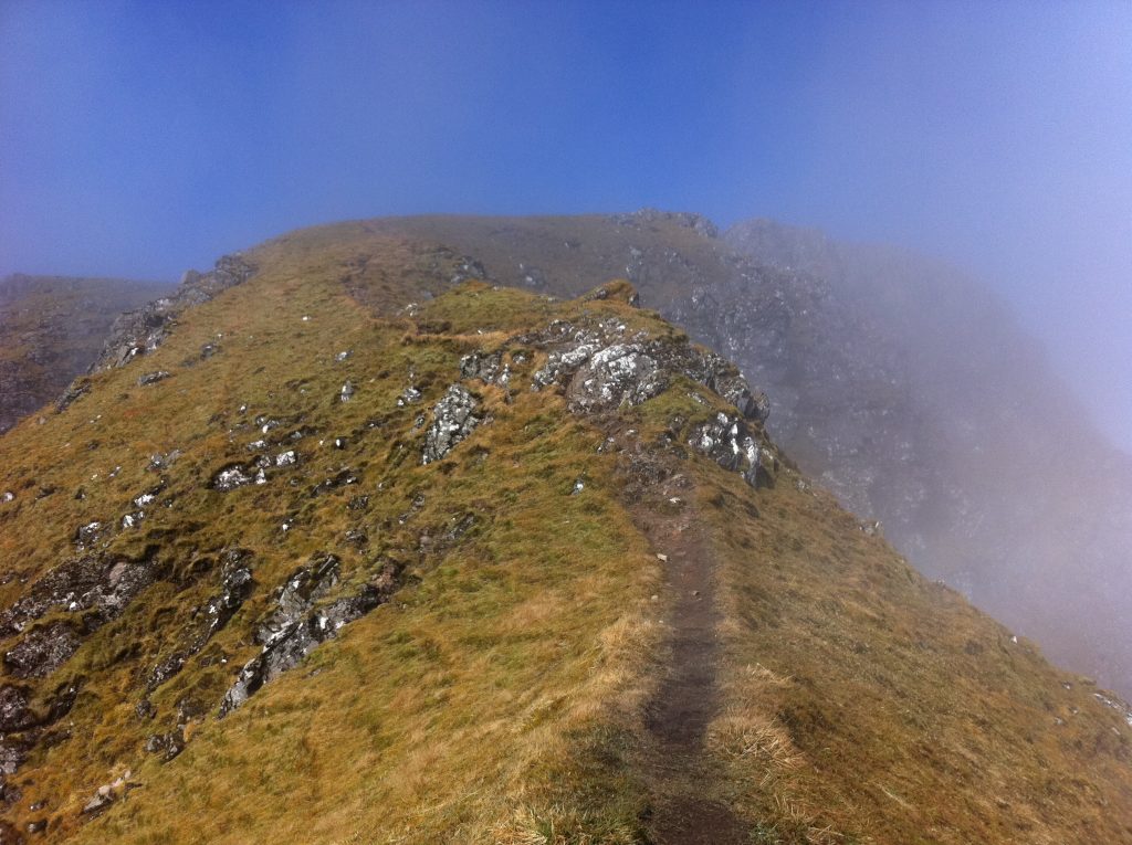
A weekend walking meet up at Kintail was fast approaching. I had booked Friday as a days holiday so that I could drive up on the Thursday night and after a pleasant drive I arrived at Loch Cluannie at around 2100. It was a wet evening with a heavy mist in the air. I met up with Danny at one of the hard standing parking areas around the Loch and after having a few whiskies decided to bed down for the night. I was up later than normal on the Friday morning and my plan was to bag a Munro on route to Kintail. I drove to Sheil Bridge then took a left on the old Military Road for 20 miles to Arnisdale. There was a heavy mist on the hilltops with the sun trying to burn through but unfortunately today it was just not strong enough and the top half of Beinn Sgriteall, my target for the day, was in the clag for most of the walk.
The Walk
By the time I got to the start of the walk, a small sign indicating the way to Beinn Sgriteall at Arnisdale, I was needing a call of nature. I spied a couple near the post office, a small hut at the back of a house, and asked them if there was a cafe nearby. The woman said “yes but its not open yet” I asked “What time is it open”. The woman replied “Monday” hahaha. I found it quite funny at the time but maybe it opens on Monday for rest of the tourist season. So my call of nature will have to be in the wild but I will spare you the gory details.
So suited and booted I was on my way following the slightly boggy track into the hillside. The track more or less heads North East all the way to the Bealach whereupon it continues West up the hillside to the spot height at 906m. The initial walk in is not too steep but after reaching the 150m contour it gets a bit steeper and stays that way until reaching the spot height. The hilltop was in the clag and this started at the 600m contour and as I progressed up the hillside I lost sight of the track. This was about 100m below the Bealach. At this point I headed North West directly up to the spot height. The ground to this point was a mixture of heather and grass with the odd boggy bit thrown in for good measure but as I ascended the terrain must have been gazed upon by Medusa because it all turned to stone.
For 100m of ascent I was in a steep scree and boulder field. I almost had an involuntary call of nature on a couple of occasions and was extremely happy when the terrain turned back to grass and the ridge flattened out near the spot height. I had met a group of walkers on the ascent and had a good chat with them. I hope they continued to the Bealach and didn’t follow me up this way. From here its only 1km to the summit of Beinn Sgritheall with 80m descent to the Bealach and 130m ascent to the summit. As I progress the mist lifts and descends just as quickly so I only get fleeting glimpses of the views which would be spectacular on a sunny day, if you like that kind of thing.
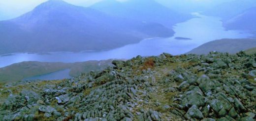
I leave the summit and descend to the Bealach below the Corbett Beinn na h-eaglaise before descending the hillside. I meet a young guy on the top and he tells me he went up the Corbett Beinn na h-eaglaise. He said it was very steep and almost a grade two scramble for most of it. Sounds interesting. I descend out of the clag to views over the Loch to knoydart and I am soon back at the car. An enjoyable workout on a warm day.