Beinn Bhuide
Statistics
Area: Inveraray to Crianlarich
Munro: Beinn Bhuidhe .
Date walked: 01/10/2009
Time taken: 4 hours 22 minutes
Distance: 22 km
Ascent: 1046m
The Route
Introduction
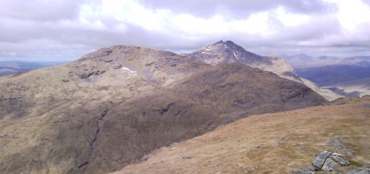
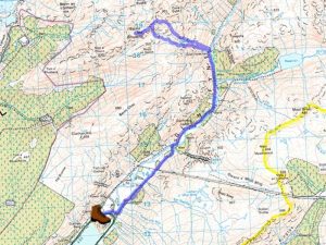
Beinn Bhuidhe is a lone Munro sitting above Glen Fynne with great views to a number of Groups of Munro’s within 10 to 15km’s. Ben Cruachan and its neighbouring Munro’s to the North West, Ben Lui and its Adjoining Munro’s to the North East with the Arrochar Alps containing 4 Munro’s and 6 Corbetts to the South East. The Munro is usually accessed from Chlachan at the head of loch Fynne with a 7.5km walk or Cycle on a good path along the Glen before starting the ascent up the Coire.
The last Munro of the week for me was to be Beinn Bhuidhe. After bagging the 4 most Northerly Munro’s I drove down from Inchnadampf on the Wednesday afternoon/evening and camped at Inveruglas on the shores of Loch Lomond for the night. After an uneventful night I was up at 7am and after breackfast I drove over to Clachan at the head of loch Fynne and parked my campervan in the car park.
The Walk
One quick change later and I was on my bike, back along the road then turning left onto the tarmac track, right across the bridge and onwards following the river into Glen Fyne. The road passes a couple of houses and fields with highland cattle and deer along the way. After a couple more km’s I cross the river on another bridge and continue for 2.5km or so arriving at a steel gate with a sign asking all cyclists to “dismount here and continue on foot”. There is even a Bike security rail so that you can easily lock the bike up. (There was a gate I had to lift the bike over but I have had a hard week and can’t remember where it was hahaha)
It’s now about a 500m walk to reach the boarded up cottage at Inverchorachan at which point I leave the track and go through a gap in the fence to walk up the south side of the Coire. I could have continued for another 50m or so before leaving the track to walk up the North side of the Coire which would have been an easier more gentle grassy ascent but today I was taking the tougher route..
There is a good small rocky path climbing up the Coire but with all the recent rain the path is wet and slippery and potentially dangerous. I found it awkward going at times and also quite tiring as it ascended the gorge. After about 700m I had ascended 300m up the gorge and there is a large rock to pass.
The path looks to be heading left and up across a small burn so I continue following it but it soon disappears. I continued climbing upwards bearing slightly right and up a steep grass slope whereupon I find the path going to the top of the gully. Once at the top it’s quite straight forward following the path onwards and upwards but as the degree of ascent reduces the hillside becomes boggier turning into a complete bog as I reach a small plateau.
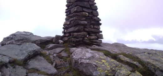
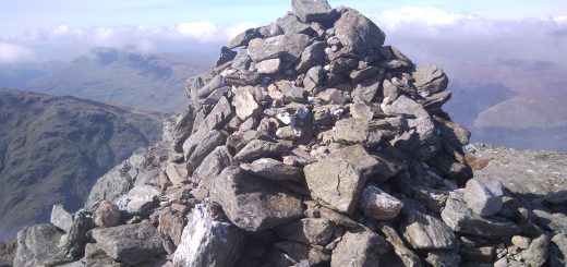
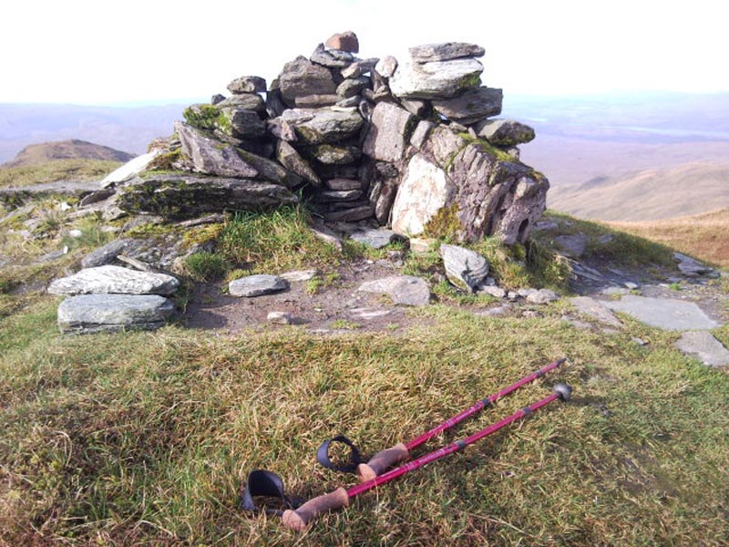
There is a small climb up to the ridge with a small cairn at the top of the path and a short walk now to the summit of Beinn Bhuide. The path skirts around the spot height with the final 10m climb up to the summit where I stop for some photos and refreshments. It’s a little bit hazy on top but the views are nice nonetheless.
I reflect on the walk up through the gorge and decide there is no way I am going back down the way I came up. Just as I am leaving the summit another walker appears and we have a quick chat. He says he came up the north side of the Glen and tells me it’s a good grassy hillside with no issues. He asks me about the south side down the gorge and I explain the problems and advise him not to go down that way.
So it’s a different way down for me. Basically I head back the way I came from the summit and reach the small cairn marking the ascent path. I decide to continue along the top for another 100m and then start to descend. There is no proper path but there are signs of Deer tracks here and there as I descend the hillside. I met another walker on his way up and again told him about the gorge.
I continued on my way picking up paths of sorts with the occasional boot marks giving me confidence that I am heading in the right direction. The underfoot conditions are good on the grassy hillside and it doesn’t take long to descend back down to the main track. The ascent and descent I chose are like chalk and cheese. One is wet, boggy, slippery, rocky and dangerous with the other a much more gentle walk on nice short grass. I was soon back on the bike pedalling like a madman back to the car park.
That was a good week’s holiday bagging 5 remote/ lone Munro’s and 800 miles of driving.