Beinn na Lap

DIGITAL IMAGE
Statistics
Area: Loch Treig to Loch Ericht
Munro: Beinn na Lap
Date walked: 02/08/2009
Time taken: 1 hour 50 minutes
Distance: 10 km
Ascent: 562m
The Route
Introduction
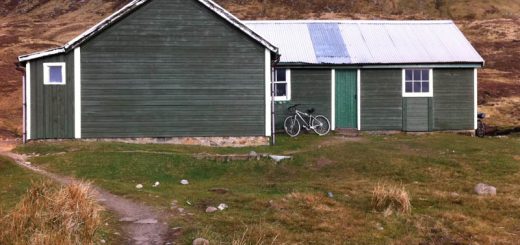
Beinn na Lap sits on its own above boggy moorland just North of Loch Ossian. It is quite remote and although it can be walked from various directions adding other Munro’s this would make for a very long day in the hills. A more suitable approach is to drive along the A86, Loch Laggan road to Tulloch Railway station North of Fersit, and catch the train to Corrour station, the highest station on the British mainland. The train journey along Loch Treig is very scenic with great views to the steep sides of the Munro’s Stob a’Choire Mheadhoin and Stob Coire Essian to the West. It’s then an easy enough walk to bag this Munro and return by train to the car.
The Walk
Well it was time to head for the hills again. My Great Nephew, Zac, was over on holiday from Australia so we decided to take him on a camping trip with the campervan and walk up Cairn Gorm from the ski centre on the Saturday. We then drove to loch Laggan to camp up for the night. There are a number of Munro’s either side of Loch Laggan that I have still to do but because Zac was up on holiday we decided to take the train to Corrour station and I would walk/run Beinn na Lap whilst the rest of the party walked the lower paths and tried their hand at fishing in Loch Ossian. So we set off on Sunday from the top end of the Loch and parked our campervans at the top of the A86 road to Tulloch station in time for the 1215 train. It’s only a 15 minute train journey to Corrour Station passing some beautiful scenery and the views to the Munro’s across Loch Treig were very impressive. Corrour, at a height of 1,338 feet, is the highest station on the British Rail network and it featured in the film Trainspotting.
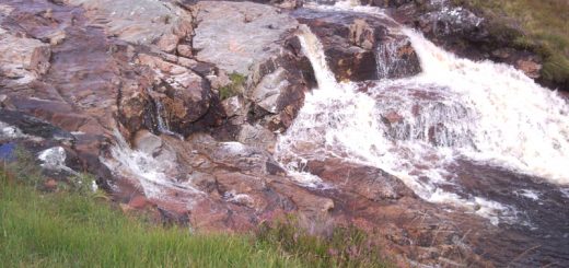
So by 1235 I was off on my lonesome journey. I set of at a jog along the track for the first 1.5km to Loch Ossian where there is a fork in the track and I then took the left fork. After another couple of hundred metres the track forks again at the head of the loch. The main track continues around the loch with a smaller track heading North West towards Loch Treig. At this point I decided to head directly North into the hillside on what looked like a track but was more like a burn/river as the heavy rain water of recent days was cascading down the hillside. The path continued for another 2km approximately before heading North East for the last 1.5km to the summit.
Now the weather had been kind to me until I got to the last 1km when I entered the mist. It wasn’t any more difficult it was just wet. At about 930 metres there is a well-built stone enclosure (shelter cairn) which could quite easily be mistaken for the summit but you have to continue for another 100 metres or so to reach the cairn at the true summit carefully avoiding the small Lochan on your way.
I stopped for 5 minutes to have a quick drink and then headed of back down the mountain. I did leave the path to try a more direct descent but came across lots of holes and underground burns on the boggy hillside and decided that it was best to re-join the path and continue my descent. I reached the fork in the road after jogging most of the way down and then jogged the 1.5km back to the station. This last bit is a pain because most of it is uphill and I was now getting tired but I was soon back at Corrour station ready for a quick bite to eat before the train journey back to the campervan.