Newtonmore Three
Statistics
Area: Glen Albyn and the Monadh Liath
Munro’s: Carn Dearg, Carn Sgulain and A’Chaileach
Date walked: 31/07/2010
Time taken: 5 hours 15 mins
Distance: 26 km
Ascent: 1000m
The Route
Introduction
With the weekend weather forecast looking grim I decided I would drive up to Drumochter. If the weather was reasonable I could do the two Munro’s on the East of Drumochter pass or carry on to Newtonmore and do the three Monadhliath munros.
So early to bed and as usual up early at 0400 and on my way by 0550. Up past Perth and northwards on the A9 until I reach Balsporran cottages and guess what, its pouring with rain hahaha. So I continue to Newtonmore, and onto the car park at the end of Glen road. I arrive at the car park at 0645 and its not raining although it is overcast and the hills are shrouded in cloud. I had planned my route and I was intent on walking clockwise.
The Walk
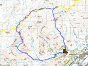
So I set off at 0651 onto the track which descends to the bridge and heads of in the direction of Glenballoch farm which I arrive at after 1.5km. At this point the most walkers head North West on a reasonable looking track up the glen but I have decided to continue South West over the bridge and past the farm.
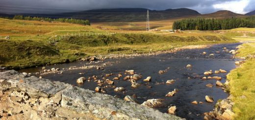
I walk along the flat Glen Banchor beside the river Calder. After just over 4km from the car park I cross the Allt Ballach which is quite wide but not in spate so its easy enough to cross. The rain has held off but I do get some slight drizzle here and there however the heather and ground is sodden and my feet are soaked in no time.
There is a bothy about 200m North but I continue West for another 800m before heading North West up Gleann Lochain towards Loch Dubh. After 3km I head North East up the slope for 1km to the beallach below Carn Dearg. For most of the journey so far there are faint tracks which disappear now and then and I occasionally head off into the heather when I lose it. Now its simply 1km on a good track to the summit of Carn Dearg.
I have been walking hard and arrive at the summit after 2hrs and 5 minutes from the car. The cairn is perched on the edge of the coire and apparently the views are excellent but due to the low cloud which I am in, with visibility of maybe 10m, I don’t see any views whatsoever.
From here it’s a long walk across the featureless landscape keeping to the high ground and the Beallachs in between. This could be difficult in the mist but it just so happens that there is a line of fence posts which go all the way to Carn Sgulain from Carn Ban, 7km approximately, which is only half a km from Carn Dearg. However its a long slog and seems never ending. The terrain underfoot is a mix of heather and boulders with a large peat bog in the Beallach below Carn Sgulain.
Along the route there were large families of Ptamigan running around after hearing my clumsy footsteps, a couple of Lochans and nothing much ealse. The mist lifts a little then descends again leaving me shrouded in my own little world as I wished for Carn Sgulain to appear. As I approach the beallach below Carn Sgulain I walk through a large peak bog which is not too boggy and after about another km I am at the summit of Carn Sgulain. There is a small cairn near the summit so don’t be fooled into thinking this is the summit. The summit cairn is a couple of hundred metres further on.
Its now 2km to the summit of A’chailleach. So I head back the way I came for about 0.5km and then head South West for half a km over some horrible peat bogs. This whole area is covered in bog. I then head south dscending and ascending directly to the summit of A’chailleach. Thats the munros bagged in 4hrs and 15mins and its now a walk downhill of 5km back to the car. I head south and pick up a path which more or less takes me to the bothy.
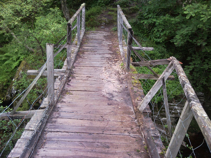
I lose the track and continue heading down in the direction of the hidden bridge over the wet heather. I soon pick up another track and in no time I reach the bridge. Its a rickety old thing and it wobbles as I cross, even under my light weight. The path from the bridge joins the main track after about 20m. There is a small pile of stones here marking the way down to the hidden bridge for those walking in. It’s now a simple 1.5km walk back to the car.

